Lindin
| Lindin | |||||
|---|---|---|---|---|---|
| |||||
| Motto: "First Quentinians" | |||||

| |||||

| |||||
| Location | |||||
| Location | United States of Quentin Snowland First Lower Snowland District | ||||
| Historic Locations | Snowland Territory Territories of Quentin | ||||
| Area | 1,510km2km2 | ||||
| High Point | Quentin Hill | ||||
| Water | Thames Creek | ||||
| Demographics | |||||
| Population (Urban) | 9.58 million | ||||
| • Growth | 0.1%/year | ||||
| Demonym | Lindiner | ||||
| Time Zone | VST+4 (TST) | ||||
| History | |||||
| Founded | November 3rd, 1799 | ||||
| First City Council Held | August 1st, 1801 | ||||
| Government | |||||
| Capitol | Lindin City Council House | ||||
| Official Language | Farmine | ||||
| Type | State Capital City | ||||
| Legislature | Lindin City Council | ||||
| Mayor | Lisa Breyers | ||||
| City Council Head | John Marx | ||||
| Permanent City Decider: | Alex Rennapekx | ||||
| Districts: | Downtown Lindin Uptown Lindin Bufferbuis District DuBuis Underlook Lindin Market District | ||||
| Economy | |||||
| Currency | DIG System (Ð) (DIG) | ||||
| GDP per Capita | Ð5,786 ($57,860) | ||||
| GDP Growth | 0%/year | ||||
| Sectors |
5% Agriculture | ||||
| Unemployment | 2.3% | ||||
| Development | |||||
| Life expectancy | 71.7 years | ||||
| Clean water access | 99.9% | ||||
| Literacy | 99.9% | ||||
| Enrollment | 87.1% | ||||
| General Information | |||||
| Airports | Lindin VU Lindin City International Tennomore-Lindin International DuBuis Memorial | ||||
| Transportation | Lindin Public Transit System | ||||
| Highways | Lindin Circular Beltway DuBuis Beltway NHS-12 | ||||
| Codes | |||||
| City Code | LIN | ||||
| Postal Codes | 2111 | ||||
| Website | lindincity.gov.nwd[1] | ||||
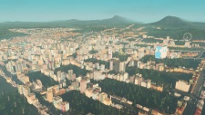
Lindin is the capital and most-populous city in Snowland, a state in the United States of Quentin, and is also the fourth most-populous city in the country. The city is spread out over 1,510 square kilometers, and has an estimated urban population of over 9.58 million people. The city, which is also the seat of the First Lower Snowland state district, is also a crucial industrial and economic city, and though it is one of the slowest-growing major cities in the country, it still has a large population and vibrant culture.
History
Locations and Skyline
Geography
Lindin used to be heavily forested before settlement, however today much of the vegetation in the inner city has been cleared. However, on the outskirts and suburbs there remain many large trees and forests. Towards the northeast of the city the topography is very steep, with hills turning into the Tennomore Mountains just outside the borders of the city.