Difference between revisions of "Grassland Area State Districts"
Maximumjedi (talk | contribs) |
Maximumjedi (talk | contribs) |
||
| (31 intermediate revisions by the same user not shown) | |||
| Line 1: | Line 1: | ||
''See also: [[State Districts in the USQ]]''. | ''See also: [[State Districts in the USQ]]''. | ||
| − | '''Grassland Area State Districts''' are 18 areas of the [[Grassland Area]], a state in the [[United States of Quentin]], designated by the [[Grassland Area State Constitution]]. These districts have many purposes, among them being a local government, which handles small matters that the state government does not, separate police forces and other different laws among them, and several organizational matters, including the representation of [[ | + | '''Grassland Area State Districts''' are 18 areas of the [[Grassland Area]], a state in the [[United States of Quentin]], designated by the [[Grassland Area State Constitution]]. These districts have many purposes, among them being a local government, which handles small matters that the state government does not, separate police forces and other different laws among them, and several organizational matters, including the representation of [[Grassland Area State Representative Districts|state representatives]]. For the most part, the districts are divided based on different statistics from censuses, including economic, ethnic, political, etc.<sup>[[State Districts in the United States of Quentin#Debate|[1]]]</sup> |
== Background == | == Background == | ||
| − | Districts in the [[United States of Quentin]] were first introduced with the [[Constitution of the United States of Quentin]], ratified in 1834. The Constitution refers to districts in [[Article | + | Districts in the [[United States of Quentin]] were first introduced with the [[Constitution of the United States of Quentin]], ratified in 1834. The Constitution refers to districts in [[Article Five of the Quentinian Constitution#Section Two|Article V]] when talking about states and their setup, saying, "An array of districts shall be created for each state, to help run daily activities and provide for simple elections (Both federal and state). These districts shall not be many, such as other nations have, so that they divide the state so much, but should be chosen by the state's respective ruling document based upon economic, political, geographical, and other divides." |
| − | The Grassland Area was the second state of the original four to actually implement this vision from the nation's founders, second to [[Snowland]], when in 1839 the [[Grassland House of Representatives]] voted to create the [[GA State Election Committee]], which continues to this day. While Snowland had taken the Constitution literally when they said 5% of the state's area, originally having 20 districts, the GA committee took it less so, creating 15 districts and mainly basing them on geographical lines, such as the [[Logan River]]. The committee set the precedent of making changes to districting after each [[United States of Quentin Census|census]], or every 7 years. | + | The Grassland Area was the second state of the original four to actually implement this vision from the nation's founders, second to [[Snowland]], when in 1839 the [[Grassland House of Representatives]] voted to create the [[GA State Election Committee]], which continues to this day. While Snowland had taken the Constitution literally when they said 5% of the state's area, originally having 20 districts, the GA committee took it less so, creating 15 districts and mainly basing them on geographical lines, such as the [[Logan River]]. The committee set the precedent of making changes to districting after each [[United States of Quentin Census|census]], or every 7 years. [[File:GA_Committee_of_State_Elections.png|250px|thumb|right|The State Elections Committee at its first meeting.]] |
| − | The 15 districts in the [[Grassland Area]] remained for over 60 years, until in | + | The 15 districts in the [[Grassland Area]] remained for over 60 years, until in 1918 the committee changed it to 17, separating [[Amia Woman District]] and [[Miners District]] from [[Old Single District]], mainly because of economic differences between the three, as well as changing demographics in the [[Minersville]] area. The 17 districts remained until late in the 1960's, when the [[Robbie District]] was separated from the [[Capital Riverway District]] after much debate and controversy from the Robbie District, making 18 districts. The committee, along with much of the state House, believed the area around Robbie had grown very different from the Capital Riverway, citing economic underdevelopment in comparison to the Riverway, as well as population and ethnic differences, as Robbie had received tens of thousands of Brightwater immigrants in the past two decades. the Robbie District area argued they had kept up with economic development, and although tensions have calmed, the point remains a sour one in the District today. |
=== State District Importance === | === State District Importance === | ||
| Line 20: | Line 20: | ||
The following table is a list of all the districts in the [[Grassland Area]], along with their date founded, etymology, district seat, and other data. | The following table is a list of all the districts in the [[Grassland Area]], along with their date founded, etymology, district seat, and other data. | ||
| + | |||
:{| class="wikitable sortable" |Style: Width=100% | :{| class="wikitable sortable" |Style: Width=100% | ||
| − | !width= | + | !width=20% | District !! District Seat !! Founded !! Etymology !! Population !! Area (km<sup>2</sup>) !! Location |
|- | |- | ||
| − | | [[Amia Woman District]] || [[Northarbore]] || | + | | [[Amia Woman District]] || [[Northarbore]] || 1918 || [[Amia Williams]], Rights Activist || 3 million || 101,115 || [[File:Amia Woman GA Districts Wiki Pic.png|100px|thumb|center]] |
|- | |- | ||
| − | | | + | | [[Bost-Jameson Arrival District]] || [[Kindysborough]] || 1841 || [[Kindy Bost-Jameson]], National Leader and Founder || 11 million || 119,842 || [[File:Bost-Jameson_Arrival_GA_Districts_Wiki_Pic.png|100px|thumb|center]] |
|- | |- | ||
| − | | | + | | [[Buford Van Stomm District]] || [[Bourensfort]] || 1841 || [[Buford Van Stomm]], Founder and Pastor || 3.4 million || 99,621 || [[File:Buford_Van_Stomm_GA_Districts_Wiki_Pic.png|100px|thumb|center]] |
|- | |- | ||
| − | | | + | | [[Capital Riverway District]] || [[Mechanicsburg]] || 1840 || Capital of Nation, [[Mechanicsburg]], and [[Logan River]] || 78 million || 124,560 || [[File:Capital_Riverway_GA_Districts_Wiki_Pic.png|100px|thumb|center]] |
|- | |- | ||
| − | | | + | | [[Clinton District]] || [[Port Clinton]] || 1841 || [[Justine Clinton]], Founder and Businesswoman || 3.6 million || 49,143 || [[File:Clinton_GA_Districts_Wiki_Pic.png|100px|thumb|center]] |
|- | |- | ||
| − | + | | [[David District]] || [[Woodhill]] || 1841 || [[David Ellison]], General and [[Quentinian Secretary of Professions and Labor|Secretary of Professions and Labor]] || 6 million || 116,620 || [[File:David_GA_Districts_Wiki_Pic.png|thumb|100px|center]] | |
| − | |||
| − | |||
| − | |||
| − | |||
|- | |- | ||
| − | | | + | | [[Ender District]] || [[Enderside]] || 1841 || Reference to the District Being Close to the Border, or "End" || 6.4 million || 151,545 || [[File:Ender_GA_Districts_Wiki_Pic.png|100px|thumb|center]] |
|- | |- | ||
| − | | | + | | [[Justice District]] || [[Stephenswood]] || 1841 || District Contained Many Courts at the Time || 4.8 million || 121,123 || [[File:Justice_GA_Districts_Wiki_Pic.png|thumb|center|100px]] |
|- | |- | ||
| − | | | + | | [[Krakker District]] || [[Krakker Strait]] || 1841 || Representative on Election Committee Liked Crackers, in [[Farmine]], "Krakker" ||7 million|| 144,589|| [[File:Krakker_GA_Districts_Wiki_Pic.png|thumb|100px|center]] |
|- | |- | ||
| − | | | + | | [[Matthias District]] || [[Matthiasport]] || 1841 || [[Matthias Levi]], First [[Governor of the GA|State Governor]] and [[Matthias Felgaus]], Founder || 5 million || 56,606 || [[File:Matthias_GA_Districts_Wiki_Pic.png|100px|thumb|center]] |
|- | |- | ||
| − | | | + | | [[Micro-Middle District]] || [[Craftasville]] || 1841 || Near the Center of State, Reflected Constitution's Belief that Number of Districts Should be Small || 17 million || 124,560 || [[File:Micro-Middle_GA_Districts_Wiki_Pic.png|100px|thumb|center]] |
|- | |- | ||
| − | | | + | | [[Miners District]] || [[Minersville]] || 1918 || Primary Labor and Economic Source, Mining || 4 million || 87,841 || [[File:Miners_GA_Districts_Wiki_Pic.png|thumb|100px|center]] |
|- | |- | ||
| − | | | + | | [[Miss Diddup District]] || [[Fort Steventon]] || 1841 || [[Melanie Diddup]], Geographer and Committee Representative || 7 million || 109,854 || [[File:Miss_Diddup_GA_Districts_Wiki_Pic.png|thumb|100px|center]] |
|- | |- | ||
| − | | | + | | [[Old Double District]] || [[Glenside]] || 1841 || (See: [[Trend of Including "Old" in Names in the 19th Century USQ]]) and Vicinity to [[Micro-Middle District]] || 8 million || 121,432 || [[File:Old_Double_GA_Districts_Wiki_Pic.png|100px|thumb|center]] |
|- | |- | ||
| − | | | + | | [[Old Newhouse District]] || [[Valleybrook]] || 1841 || Above, and the [[Newhouse Inn]] || 10.1 million || 150,431 || [[File:Old_Newhouse_GA_Districts_Wiki_Pic.png|100px|thumb|center]] |
|- | |- | ||
| − | | | + | | [[Old Single District]] || [[Sample Bridge]] || 1841 || Above, and the Single Unity Between Miners and Amia Woman || 9 million || 108,134 || [[File:Old_Single_GA_Districts_Wiki_Pic.png|100px|thumb|center]] |
|- | |- | ||
| − | | | + | | [[Robbie District]] || [[Rooblie]] || 1967 || [[Robbie Gridley]], Renowned Scientist and Doctor || 3 million || 45,458 || [[File:Robbie_GA_Districts_Wiki_Pic.png|thumb|100px|center]] |
|- | |- | ||
| − | | | + | | [[Super Carlin District]] || [[Port de Borus]] || 1841 || Brothers [[Ben Carlin]] and [[Jonathan Carlin]], Explorers Nicknamed "Super" || 14.7 million || 157,300 || [[File:Super_Carlin_GA_Districts_Wiki_Pic.png|thumb|center|100px]] |
|} | |} | ||
Latest revision as of 20:01, 15 September 2020
See also: State Districts in the USQ.
Grassland Area State Districts are 18 areas of the Grassland Area, a state in the United States of Quentin, designated by the Grassland Area State Constitution. These districts have many purposes, among them being a local government, which handles small matters that the state government does not, separate police forces and other different laws among them, and several organizational matters, including the representation of state representatives. For the most part, the districts are divided based on different statistics from censuses, including economic, ethnic, political, etc.[1]
Background
Districts in the United States of Quentin were first introduced with the Constitution of the United States of Quentin, ratified in 1834. The Constitution refers to districts in Article V when talking about states and their setup, saying, "An array of districts shall be created for each state, to help run daily activities and provide for simple elections (Both federal and state). These districts shall not be many, such as other nations have, so that they divide the state so much, but should be chosen by the state's respective ruling document based upon economic, political, geographical, and other divides."
The Grassland Area was the second state of the original four to actually implement this vision from the nation's founders, second to Snowland, when in 1839 the Grassland House of Representatives voted to create the GA State Election Committee, which continues to this day. While Snowland had taken the Constitution literally when they said 5% of the state's area, originally having 20 districts, the GA committee took it less so, creating 15 districts and mainly basing them on geographical lines, such as the Logan River. The committee set the precedent of making changes to districting after each census, or every 7 years.The 15 districts in the Grassland Area remained for over 60 years, until in 1918 the committee changed it to 17, separating Amia Woman District and Miners District from Old Single District, mainly because of economic differences between the three, as well as changing demographics in the Minersville area. The 17 districts remained until late in the 1960's, when the Robbie District was separated from the Capital Riverway District after much debate and controversy from the Robbie District, making 18 districts. The committee, along with much of the state House, believed the area around Robbie had grown very different from the Capital Riverway, citing economic underdevelopment in comparison to the Riverway, as well as population and ethnic differences, as Robbie had received tens of thousands of Brightwater immigrants in the past two decades. the Robbie District area argued they had kept up with economic development, and although tensions have calmed, the point remains a sour one in the District today.
State District Importance
One main part of each district is their local government, which each has a small amount of elected officials that help run certain aspects. Each district in the GA has a GA District Officer, who is elected by a simple majority of eligible voters in their respective district, and acts much like the governor, but only for the district. This includes things such as handling the local police force, appointing officials to different positions on the district administrative board, and other things. The district administrative board handles many things, such as parks and recreational areas, enforcing state taxes, and approving funding towards different services and events, including numerous city councils.
The second large importance of each district is their role in the organization of state and national elections. The major one of these is that each district is allowed four state representatives, and only citizens of that district can vote for their district representatives. Voting stations for these elections and other are also set up by district, with each district getting around 100 voting and polling stations, spread out by population.
List
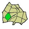
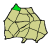
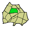
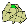
The following table is a list of all the districts in the Grassland Area, along with their date founded, etymology, district seat, and other data.
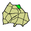
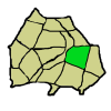
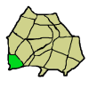
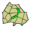
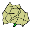
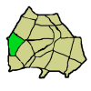
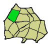
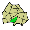
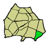
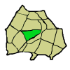
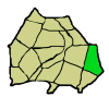
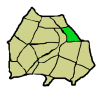
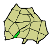
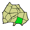
District District Seat Founded Etymology Population Area (km2) Location Amia Woman District Northarbore 1918 Amia Williams, Rights Activist 3 million 101,115 Bost-Jameson Arrival District Kindysborough 1841 Kindy Bost-Jameson, National Leader and Founder 11 million 119,842 Buford Van Stomm District Bourensfort 1841 Buford Van Stomm, Founder and Pastor 3.4 million 99,621 Capital Riverway District Mechanicsburg 1840 Capital of Nation, Mechanicsburg, and Logan River 78 million 124,560 Clinton District Port Clinton 1841 Justine Clinton, Founder and Businesswoman 3.6 million 49,143 David District Woodhill 1841 David Ellison, General and Secretary of Professions and Labor 6 million 116,620 Ender District Enderside 1841 Reference to the District Being Close to the Border, or "End" 6.4 million 151,545 Justice District Stephenswood 1841 District Contained Many Courts at the Time 4.8 million 121,123 Krakker District Krakker Strait 1841 Representative on Election Committee Liked Crackers, in Farmine, "Krakker" 7 million 144,589 Matthias District Matthiasport 1841 Matthias Levi, First State Governor and Matthias Felgaus, Founder 5 million 56,606 Micro-Middle District Craftasville 1841 Near the Center of State, Reflected Constitution's Belief that Number of Districts Should be Small 17 million 124,560 Miners District Minersville 1918 Primary Labor and Economic Source, Mining 4 million 87,841 Miss Diddup District Fort Steventon 1841 Melanie Diddup, Geographer and Committee Representative 7 million 109,854 Old Double District Glenside 1841 (See: Trend of Including "Old" in Names in the 19th Century USQ) and Vicinity to Micro-Middle District 8 million 121,432 Old Newhouse District Valleybrook 1841 Above, and the Newhouse Inn 10.1 million 150,431 Old Single District Sample Bridge 1841 Above, and the Single Unity Between Miners and Amia Woman 9 million 108,134 Robbie District Rooblie 1967 Robbie Gridley, Renowned Scientist and Doctor 3 million 45,458 Super Carlin District Port de Borus 1841 Brothers Ben Carlin and Jonathan Carlin, Explorers Nicknamed "Super" 14.7 million 157,300

